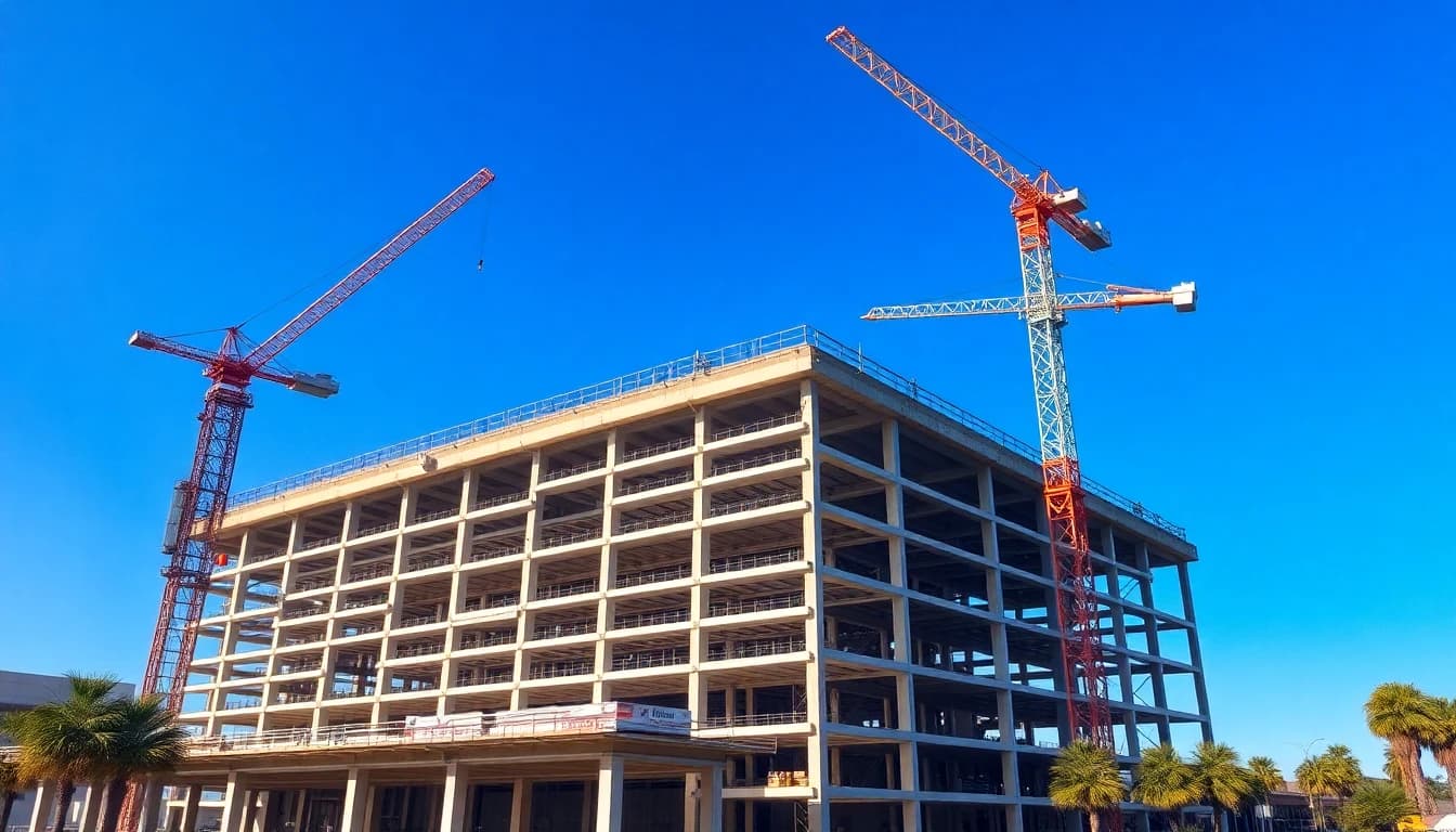
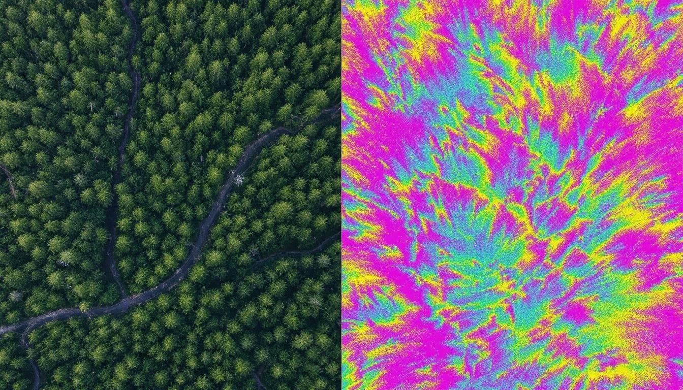
Aerial Surveying & LiDAR
Every inch of
your site. Mapped.
Sub-2cm terrain data delivered in 48 hours — ready for your CAD, GIS, or engineering workflow.
01/By the Numbers
Survey-grade,
every flight.
Calibrated equipment, certified pilots, and rigorous QA — measurable across every site we map in Southern California.
<2cm
Vertical Accuracy
Verified against NGS-published control
240k
Points / Second
Zenmuse L2 LiDAR, 5 returns per pulse
48h
Turnaround
Most sites delivered in 2–3 business days
6
SoCal Counties
Blanket COA for controlled airspace
02/What We Do
Services
End-to-end drone imaging solutions — from flight planning to final deliverables. Every dataset is processed to survey-grade accuracy.

Aerial Photogrammetry
Centimeter-accurate site maps from aerial imagery. Multi-sensor acquisition at 1–2 cm/px GSD, processed into dense point clouds, DSMs, and classified orthomosaics with RTK/PPK georeferencing.

Orthomosaic Mapping
Distortion-free aerial maps ready for your GIS or CAD platform. Radiometrically corrected GeoTIFF orthomosaics georeferenced to NAD83/WGS84 — direct import into ArcGIS, QGIS, or Civil 3D.

3D Terrain Modeling
Detailed surface models for grading, drainage, and design. Bare-earth DTMs and first-return DSMs at 5–10 cm resolution, delivered as TIN meshes, raster grids, or contour lines in LandXML, DXF, and GeoTIFF.

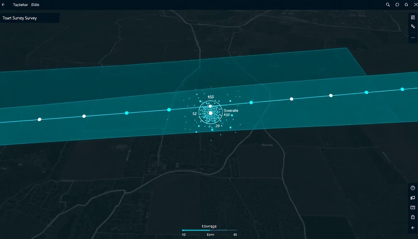
LiDAR Scanning
See through vegetation to the bare earth beneath. Airborne LiDAR with the Zenmuse L2 — 5 returns per pulse, 240k pts/sec, canopy-penetrating wavelength. Classified LAS/LAZ point clouds with sub-2cm accuracy.

Volumetric Analysis
Accurate stockpile measurements without shutting down operations. Drone-derived surface models with ±1.5% accuracy, repeat flyovers for automated change detection and earthwork verification against design surfaces.
Construction Monitoring
Track construction progress against your design model. Periodic aerial captures compared to BIM/CAD to quantify deviation and verify as-built conditions. 4D timeline maps with automated progress reporting.
03/How We Work
Our Process
Scope
Site review, GSD/overlap spec, GCP layout planning, airspace authorization (LAANC), and deliverable format agreement.
Capture
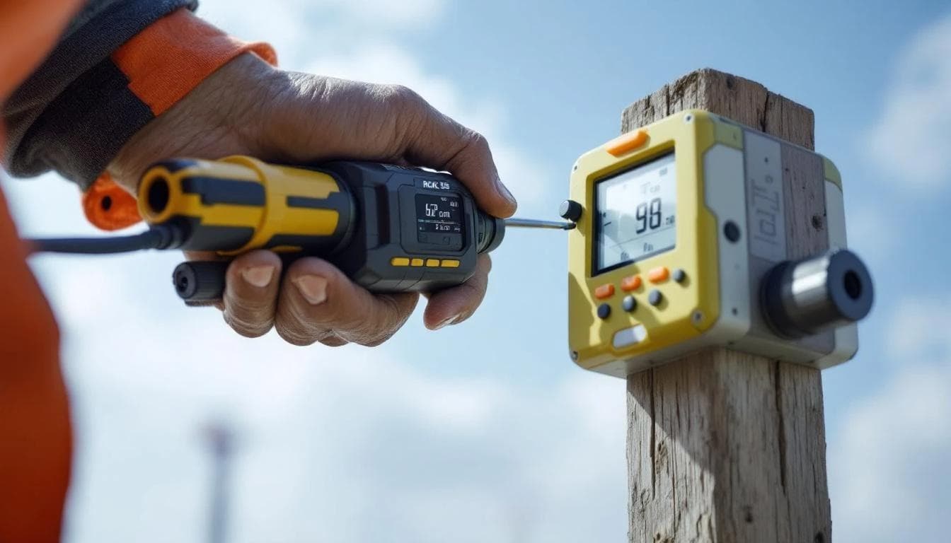
RTK/PPK-enabled flight execution with redundant GNSS base station. Automated waypoint missions at calculated altitude for target resolution.
Process
SfM/MVS photogrammetric reconstruction or LiDAR point cloud classification. QA against ground control with RMSE reporting.
Deliver
Georeferenced deliverables in your CRS — GeoTIFF, LAS/LAZ, DXF, LandXML, Shapefile. Full metadata and accuracy report included.
04/Deliverables
Survey-Grade Output
Every dataset undergoes rigorous QA against ground control points. We deliver in your coordinate reference system, in formats your team already uses.
Classified Point Clouds
Dense LAS/LAZ with ground, vegetation, and structure classes. Up to 500 pts/m² from LiDAR, 200 pts/m² from photogrammetry.
DTM / DSM Generation
Bare-earth and first-return surface models at 5–10 cm grid resolution. TIN mesh, raster grid, and contour line output.
Georeferenced Orthomosaics
True-ortho GeoTIFF at 1–2 cm/px with embedded CRS. Direct import into ArcGIS, QGIS, AutoCAD Civil 3D, and Global Mapper.
Elevation Heatmaps
Color-coded elevation rasters with contour overlays for quick visual analysis. Ideal for grading verification and drainage studies.
Flight Planning & QA
Automated waypoint missions with calculated GSD, overlap, and sidelap. Post-flight QA includes RMSE reporting against GCPs.
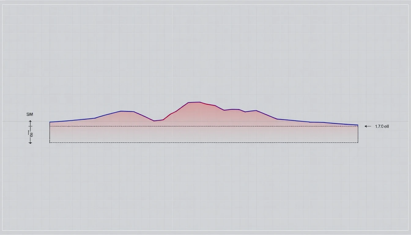
Cross-Sections & Profiles
Terrain profiles extracted at any alignment. Cut/fill volumes calculated between existing surface and design grade.
Ready to map your site?
Get a detailed scope and estimate within 24 hours.
05/Who We Work With
Industries
we serve.
Specialized workflows for the disciplines that depend on precise terrain data — engineered for the people who plan, design, and build.
Vertical 01
Land Development
Site planning, grading design, topo surveys, and boundary verification for residential and commercial projects.
We deliver bare-earth DTMs at 5–10 cm resolution, contour packages in LandXML and DXF, and full-site orthomosaics that drop directly into AutoCAD Civil 3D.
Vertical 02
Construction
Progress monitoring, as-built verification, BIM overlay, and earthwork quantity tracking throughout the build cycle.
Repeat flyovers feed automated change detection — quantify every cubic yard moved between captures and compare against design surfaces with millimeter rigor.
Vertical 03
Infrastructure
Road corridors, bridges, utilities, and stormwater systems — mapped to survey-grade for design and compliance.
Linear corridor missions, structural inspection captures, and dam/levee deformation monitoring with classified LAS/LAZ point clouds and full metadata.
07/Common Questions
FAQ
How quickly are drone survey results delivered?
Most sites are fully delivered within 48–72 hours of the flight date. Rush turnaround is available on request for time-sensitive projects.
Do your pilots hold FAA Part 107 certification?
Yes — all Twinn Digital pilots are FAA Part 107 certified. We also hold a blanket COA for controlled airspace across Southern California, including Class B/C/D airspace around LAX, SAN, and regional airports.
What does a drone survey cost?
Pricing depends on site size, terrain complexity, and deliverable type. Small sites typically start around $800. Commercial and industrial sites are quoted individually — contact us for a same-day estimate.
Will the data work in my existing software?
Yes. We deliver in GeoTIFF, LAS/LAZ, DXF, LandXML, Shapefile, and GeoJSON — fully compatible with AutoCAD Civil 3D, ArcGIS, QGIS, Global Mapper, and most industry platforms.
—/Who We Are
Built on accuracy.
Driven by data.
Twinn Digital provides survey-grade aerial data for land development, construction, and infrastructure projects across Southern California. We fly RTK/PPK-enabled platforms with photogrammetric and LiDAR sensors, and deliver sub-2cm accuracy verified against NGS-published control.
Fleet: DJI Matrice 350 RTK + Zenmuse L2 LiDAR (5-return, 240k pts/sec) · DJI Mini 5 Pro · Emlid RS3 GNSS base stations
All of Southern California
Blanket COA for controlled airspace across LA, Orange County, Riverside, San Bernardino, Ventura, and San Diego.
Your Formats, Your CRS
Deliverables in NAD83, CA State Plane, or any CRS — compatible with AutoCAD Civil 3D, ArcGIS, QGIS, and Global Mapper.

06/Client Feedback
What clients say
“The LiDAR dataset integrated directly into our Civil 3D workflow without any cleanup. Sub-2cm accuracy across the full 80-acre site — faster and cheaper than traditional survey by a wide margin.”
Ryan M.
Project Engineer — Land Development, LA County
“We needed an orthomosaic for a FEMA submittal with a tight deadline. Twinn had the data processed and delivered within 72 hours of the flight. The HEC-RAS models ran first try.”
Carlos V.
Senior Hydrologist — Municipal Consulting, Orange County
“We've standardized on Twinn Digital for all our construction progress monitoring. The consistency between captures is critical for our deviation reporting, and they've never missed a scheduled flyover.”
Amanda T.
Construction Manager — General Contracting, Inland Empire
FAA
Part 107 Certified
ASPRS
Member
Insured
$2M Liability Coverage
08/From the Blog
Latest Insights
Drone LiDAR Accuracy: What Sub-2cm Really Means and How to Verify It
Sub-2cm accuracy is the standard marketing claim for drone LiDAR. Here's what that specification actually means, how to test it rigorously, and the factors that make or break real-world accuracy.
Read article →

Drone Survey Data That Actually Works in Civil 3D (Without the Headaches)
Raw drone survey data and Civil 3D don't get along. Massive point clouds, CRS mismatches, unclassified noise, and dumb decimation create hours of rework. Here's what your drone surveyor should be delivering — and what to demand if they're not.
Read article →
LiDAR vs. Photogrammetry: Which One Your Project Actually Needs
An honest, practical comparison of drone LiDAR and photogrammetry — when each technology wins, what they really cost, and how to pick the right one for your project type.
Read article →
09/Get In Touch
Start a Project
info@twinndigital.com
Phone
(310) 243-6223Location
Southern California
Serving all of SoCal
Hours
Mon — Fri, 8am — 6pm PST
Flights scheduled 7 days/week