LiDAR vs. Photogrammetry: Which One Your Project Actually Needs
April 1, 2026
If you've already read the broader three-way comparison of LiDAR, photogrammetry, and traditional survey, this post zooms in on the specific decision most clients are actually making: drone LiDAR or drone photogrammetry, for a given project. Instead of a parallel spec table, here are the project scenarios that drive the choice — with the underlying technical reason and what the deliverables look like in each case.
The single most important difference
Photogrammetry reconstructs a 3D surface from overlapping photos using Structure-from-Motion algorithms. It maps the top of whatever the camera can see. LiDAR fires laser pulses that can pass through gaps in vegetation and record multiple returns — canopy top, mid-canopy, ground — from a single pulse.
Every other technical difference (accuracy, point density, cost, processing time) ultimately routes back to that core distinction. If the bare-earth surface is what you need and there's anything between the camera and the ground — vegetation, brush, low crops, even tall grass — photogrammetry will give you the wrong answer with high precision.
Scenario-by-scenario picks
Open-terrain construction pad
A 30-acre bare-earth pad in Riverside County, freshly graded, no vegetation. Photogrammetry. With RTK GNSS and a handful of ground control points, photogrammetry achieves 3–5 cm RMSE on hard surfaces and the orthomosaic that comes out of the same flight is genuinely useful for documentation. LiDAR works too, but photogrammetry is typically 30–50% cheaper and the visual product adds value.
Stockpile volumes at an aggregate yard
Photogrammetry. Stockpiles are bare, the surface texture is excellent for SfM feature matching, and the visual record helps with auditing. Industry-standard practice for stockpile-volume work. We've used photogrammetry on multiple SoCal aggregate operations with consistent ±1–2% volume accuracy on individual piles.
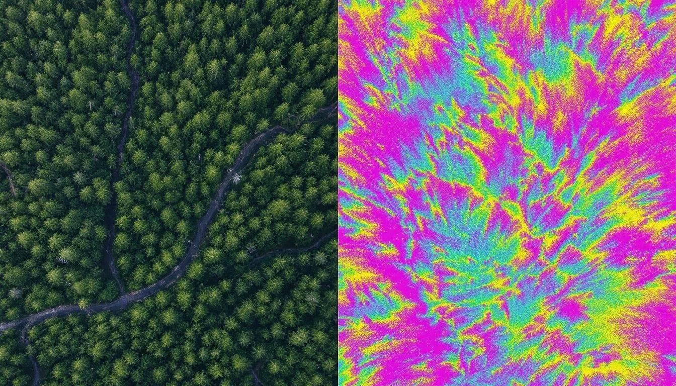
Hillside drainage study with chaparral cover
LiDAR. This is the canonical wrong-tool-for-the-job scenario for photogrammetry. The brush is uniform, the model has no idea where the actual ground is, and the resulting bare-earth DEM will be biased high by 30–80 cm depending on shrub density. Drainage design built on that DEM will undersize or misroute conveyance structures.
LiDAR penetrates the canopy. Even on dense coastal sage scrub, the DJI Zenmuse L2 we operate produces enough ground returns at 80 m AGL to deliver a bare-earth DEM with 5–10 cm vertical RMSE under the brush — verified against checkpoints on adjacent open ground.
Construction progress monitoring (active site)
Photogrammetry, usually. Active sites are typically large, mostly bare, and benefit enormously from the visual orthomosaic at 2–5 cm/pixel. Photogrammetry-derived terrain is plenty accurate for cut/fill verification on cleared ground. Switch to LiDAR if the site has retained vegetation, water on the ground, or recently disturbed material with poor visual texture.
Watershed planning with riparian corridors
LiDAR. Stream corridors are vegetated by definition, and the question — where does water actually go — depends on the bare-earth surface beneath the vegetation. Photogrammetry produces a confident-looking but wrong canopy model. LiDAR delivers the ground-classified point cloud that hydrologic and hydraulic models actually need. See our watershed development guide for the full methodology.
Powerline / utility corridor inspection
LiDAR. Corridor work needs both bare-earth terrain (clearance analysis) and accurate wire / structure geometry (sag, attachment points). Photogrammetry struggles with thin features like conductors. LiDAR captures wire positions directly as point returns and the bare ground beneath them — both in a single flight.
Solar farm or large agricultural site selection
Depends on the vegetation. Cleared land or post-harvest bare fields: photogrammetry is fine. Land with standing crops, perennial pasture, or scrub: LiDAR. The decision criterion is the same: does anything on the surface block the camera's view of the actual ground?
Post-wildfire erosion and runoff assessment
Mixed — both have a role. The burned landscape itself often becomes photogrammetry-friendly (vegetation removed by fire). But if the question is about pre-fire vs post-fire change, the pre-fire terrain may need to come from existing LiDAR or 3DEP coverage, and the post-fire follow-up flights can usually be photogrammetric if access is unrestricted.

Boundary or legal survey work
Neither. Boundary work requires a licensed surveyor with a total station or RTK rover producing a sealed record. See the three-way comparison post for the role of traditional ground survey.
What you actually get from each (and why it matters)
From photogrammetry
- A 3D mesh and dense point cloud derived from overlapping images, typically 200+ points per square meter on surfaces with good texture.
- A high-resolution orthomosaic at 2–10 cm per pixel (this is the visual product — a flat, georeferenced aerial photo of the site).
- A digital surface model (DSM) — the top-of-canopy / top-of-roof / top-of-stockpile surface.
- A digital terrain model (DTM / bare earth) only if there's enough bare ground to filter — on a vegetated site, this is unreliable.
From LiDAR
- A classified point cloud in ASPRS LAS/LAZ format with returns sorted into ground, vegetation tiers, buildings, water, and noise. 100–400+ pts/m² typical.
- A bare-earth DEM at 10–50 cm resolution, derived from ground-classified returns. This is the workhorse deliverable for any hydrologic or grading workflow.
- Optionally: digital surface model, canopy height model, intensity raster, contour lines, slope/aspect rasters.
- A formal accuracy report against ASPRS Edition 2 (2024) with NVA and VVA values.
Note that photogrammetry doesn't naturally produce a usable bare-earth model in vegetated terrain. It's not a deliverable-quality issue — it's a fundamental sensor limitation.
Quick numbers
Headline specs from each method, anchored to source documentation:
Photogrammetry (drone, RTK + GCP)
- Vertical RMSE: 3–10 cm on hard surfaces under controlled conditions
- Horizontal RMSE: 2–5 cm
- Orthomosaic GSD: 2–10 cm/pixel
- Ground penetration: zero

LiDAR (DJI Zenmuse L2 with PPK)
- Pulse rate: 240k points/sec single return, 1.2M points/sec multi-return
- Vertical RMSEz: 2–5 cm on bare earth, 5–15 cm under canopy
- Horizontal RMSE: 1–3 cm with RTK/PPK
- Point density: 100–400+ pts/m² in production
- Ground penetration: yes (multiple returns)
The rule of thumb
If you can stand at the project and look at exposed bare ground across most of the site, photogrammetry is probably the right answer and will cost less. If you can stand at the project and see vegetation, brush, low crops, or anything else between the air and the ground, LiDAR is the right answer for the terrain product.
There's a corollary that surprises people: if the site is fully bare but the deliverable needs the most defensible accuracy report — a regulatory submittal, a high-stakes design — LiDAR still wins because QL2-grade LiDAR is FEMA's current minimum for floodplain mapping work, and the formal ASPRS reporting framework is more rigorous on bare earth too.
What this costs in practice
Detailed cost ranges are in our 2026 cost guide. The short version: photogrammetry typically runs 30–50% less than LiDAR for the same acreage, driven by hardware cost and acquisition time. The cost-decision question is whether the savings are worth the limitations on terrain accuracy and vegetation penetration — for most clients in vegetated SoCal terrain, the answer ends up being no.
Sources cited in this article
- DJI — Zenmuse L2 official specifications
- ASPRS — Positional Accuracy Standards Edition 2 (2024)
- ASPRS — LAS/LAZ file format
- USGS — 3DEP Topographic Data Quality Levels
- USGS — 3DEP and Flood Risk Management (FS 2017-3081)
- USGS — FY25 3DEP Coverage Status
- MDPI Drones (2025) — UAV photogrammetry accuracy with RTK and GCPs
- Tandfonline (2023) — RTK/PPK UAV-photogrammetry accuracy assessment
- FAA — Part 107 Small UAS Rule