Why Water Infrastructure Fails: The Terrain Data Gap
January 21, 2026
Every year, billions of dollars are invested in water infrastructure — farm ponds, check dams, drainage channels, culverts, detention basins, irrigation systems, and flood control structures. A significant percentage of these investments underperform or fail outright. The World Bank estimates that poor planning and design account for a substantial share of water infrastructure failures globally.
The failure rate is not evenly distributed. Well-engineered structures built with adequate design data perform as intended for decades. Structures built on insufficient terrain data — designed from satellite imagery, outdated maps, or visual site assessment — fail at rates that should alarm anyone involved in funding, designing, or building water infrastructure.
The difference between success and failure is almost always the same: the quality of the terrain data that informed the design.
The Data Gap
Water infrastructure design is fundamentally a terrain problem. Where should a check dam be placed? At the point in a drainage channel where the contributing catchment area is large enough to justify the structure and the channel gradient provides adequate storage volume behind the dam. How do you determine those parameters? From a terrain model.
Where should a farm pond be located? At a natural depression with the largest possible contributing watershed and the deepest possible storage volume per unit of earthwork. How do you identify that location? From a terrain model.
What size should a culvert be? Large enough to convey the peak flow from its contributing drainage area during the design storm. What determines the drainage area and flow concentration? The terrain model.
In every case, the terrain model is the foundational input. And in every case, the quality of the terrain model determines whether the design works or doesn't.
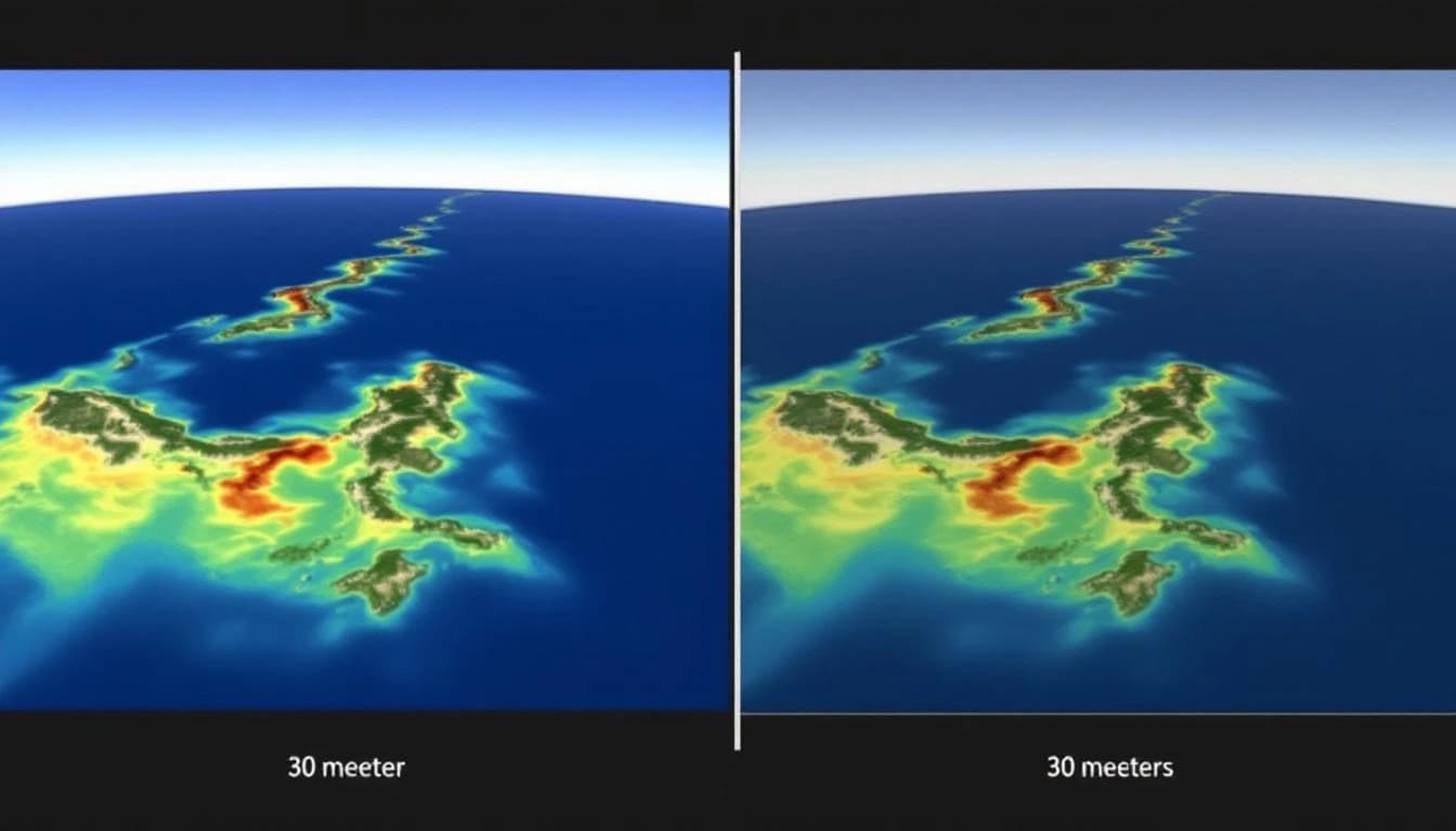
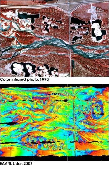
Here's where the gap emerges. The most widely available terrain data — satellite-derived digital elevation models such as the USGS SRTM dataset — has a resolution of 30 meters and a vertical accuracy of 5 to 10 meters. This means each pixel represents a 30-meter square, and the elevation value for that pixel could be off by the height of a two-story building.
Water management decisions that depend on elevation differences of 10 to 50 centimeters — channel slopes, pond depths, dam heights, drainage divides — cannot be made reliably from data with meter-scale errors. Yet this is exactly the data that many water projects rely on.
What Happens When the Data Is Wrong
The consequences of terrain data errors cascade through the entire project:
Incorrect watershed boundaries. A 30-meter DEM places the drainage divide in a different location than reality. The calculated catchment area is wrong. The structure is sized for a watershed that doesn't match the one actually contributing water. Result: underperformance (too little inflow) or overtopping (too much inflow).
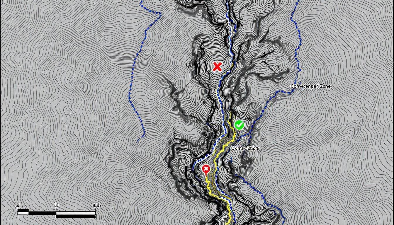
Wrong placement. A check dam placed at a point that satellite data identifies as a drainage convergence may actually sit on a local high point when measured at centimeter resolution. The dam doesn't intercept the flow path it was designed for. Result: water bypasses the structure.
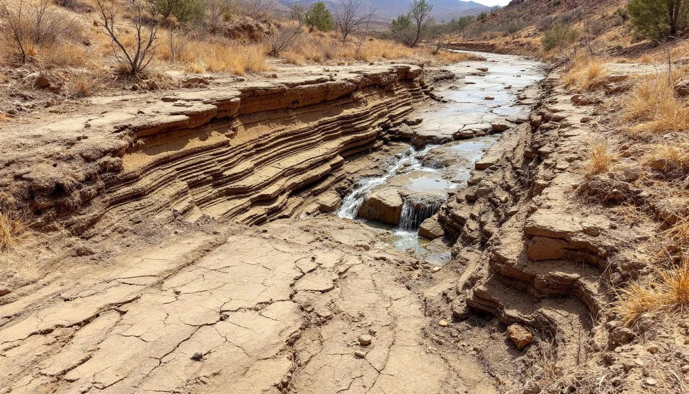
Incorrect storage calculations. Pond and reservoir storage volumes calculated from low-resolution terrain data contain large errors because the shape of the depression — its depth, slope, and extent — is poorly represented. A pond designed for 10,000 cubic meters of storage may actually hold 6,000. Result: insufficient storage for the intended purpose.
Inadequate slopes for channels and conveyances. Irrigation channels and drainage ditches require specific slope gradients. When the design is based on terrain data with meter-scale accuracy, the actual slope may differ significantly from the design slope. Result: water doesn't flow as intended — pooling in some sections, eroding in others.
The Resolution Required
For engineering-grade water infrastructure design, terrain data needs to meet specific resolution and accuracy thresholds:
Check dams and weirs: 10-25 cm DEM resolution, sub-10 cm vertical accuracy. The dam height, spillway elevation, and storage volume calculations all depend on accurate representation of the channel cross-section and upstream terrain.
Farm ponds and detention basins: 10-50 cm resolution, sub-10 cm vertical accuracy. Storage volume curves (the relationship between water depth and stored volume) are sensitive to terrain representation at the margins of the basin.
Irrigation channels: 10-25 cm resolution, sub-5 cm vertical accuracy. Channel slope design requires the highest accuracy because functional slopes are typically 0.1% to 0.5% — elevation changes measured in single centimeters per 10 meters.
Culverts and drainage infrastructure: 25-50 cm resolution, sub-10 cm vertical accuracy. Contributing watershed delineation and peak flow estimation require accurate representation of drainage divides and flow concentration patterns.
Flood mapping and simulation: 10-50 cm resolution, sub-5 cm vertical accuracy. Flood inundation mapping is extremely sensitive to terrain accuracy because the difference between flooding and not flooding at any location may be a few centimeters of elevation.
Drone LiDAR routinely delivers 10 to 25 cm resolution DEMs with sub-5 cm vertical accuracy — meeting or exceeding the requirements for every application listed above. The USGS 3D Elevation Program has documented these accuracy standards extensively across thousands of projects nationwide.
The Cost of Getting It Right vs. Getting It Wrong
A drone LiDAR survey for a water infrastructure project typically costs 1 to 5 percent of the total project budget. The survey provides terrain data that ensures the design is based on reality rather than approximation.
The cost of a failed structure — one that doesn't fill, doesn't drain, doesn't hold, or doesn't convey as designed — includes the original construction cost (lost), the redesign cost, the reconstruction cost, the opportunity cost of the time lost, and in some cases the cost of damage caused by the failure.
For a farm pond that fails to fill because it was placed in the wrong catchment: the farmer loses the construction cost, loses the season's water storage, and must either abandon the investment or pay again to relocate it. Total cost: 2 to 5 times the original investment.
For a municipal culvert that is undersized because the drainage area was incorrectly calculated: the city faces repeated flooding complaints, potential property damage claims, and the cost of upsizing the culvert after the road is already built. Total cost: 3 to 10 times what the correct culvert would have cost initially.
In every scenario, the cost of failure vastly exceeds the cost of the terrain data that would have prevented it.
Closing the Gap
The terrain data gap is not a technology problem — the technology to capture centimeter-resolution terrain data has existed for years and is becoming more accessible and affordable. It is a procurement and specification problem. Projects that specify high-resolution terrain data as a prerequisite for design consistently produce better outcomes. Projects that proceed with whatever terrain data happens to be available consistently produce more failures.
For project managers, engineers, and funding agencies, the implication is clear: include high-resolution terrain data collection as a standard line item in water infrastructure project budgets. The cost is modest. The return — in structures that work, investments that perform, and infrastructure that serves its intended purpose — is enormous.
Water infrastructure is too expensive and too important to build on bad data.