12 Questions to Ask a Drone LiDAR Survey Provider
March 4, 2026
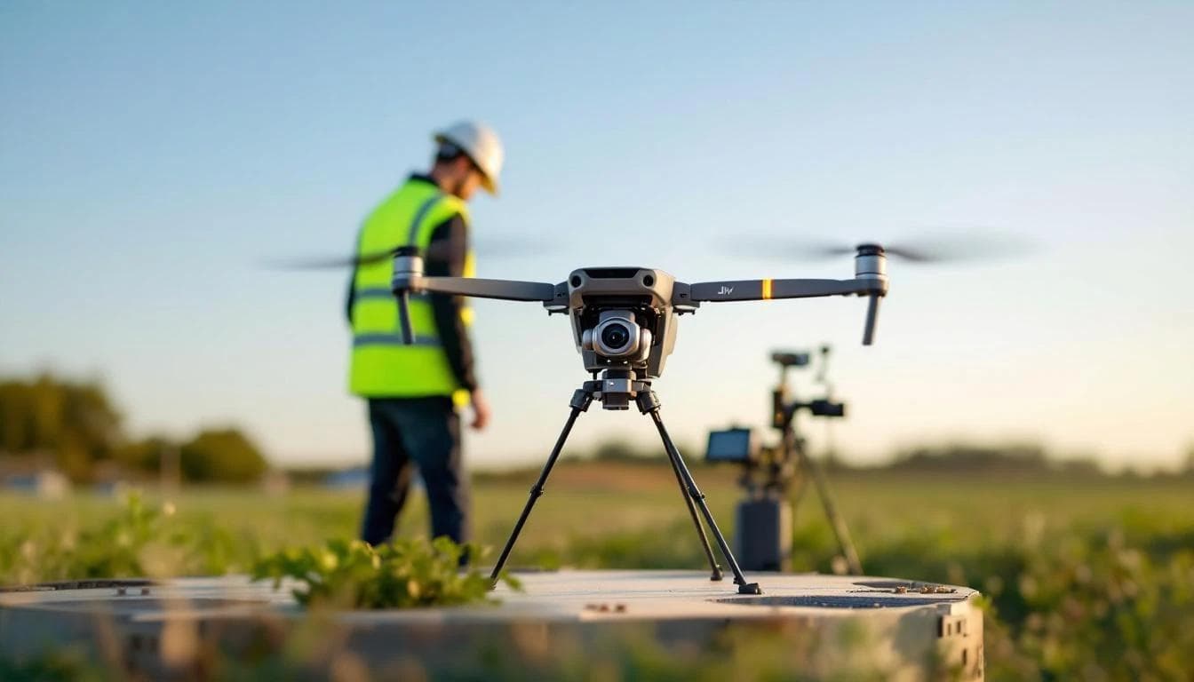
Hiring a drone LiDAR provider involves more verifiable checks than the typical "check references and ask about experience" advice suggests. Most of the right questions map directly to a real standard, regulation, or spec — and the provider's answer should reference that source. Twelve concrete questions you can ask, with the underlying standard each one anchors to.
Credentials and compliance
1. Are your pilots FAA Part 107 certified?
Required by federal law for any commercial drone operation. FAA Part 107 (14 CFR Part 107) requires a remote pilot certificate for anyone flying a drone for commercial purposes. Ask for the pilot's certificate number — they're publicly verifiable through the FAA Airmen Inquiry. A provider operating without Part 107 is committing a federal violation and the resulting work can't be insured or accepted by most procurement processes.
2. Are your aircraft registered and Remote ID compliant?
FAA Remote ID rules require all commercial drones over 0.55 lbs to broadcast identification while in flight. Compliance has been mandatory since September 2023. Ask which aircraft they're flying and whether Remote ID is enabled — modern enterprise platforms like the DJI Matrice 350 RTK include it natively.
3. How do you handle controlled airspace?
Most of urbanized Southern California sits under Class B, C, or D airspace requiring authorization. FAA's LAANC system (Low Altitude Authorization and Notification Capability) provides near-real-time airspace authorization. A competent provider knows how to file LAANC requests, when a blanket COA is appropriate, and when manual ATC coordination is required. Vague answers here predict project delays.
4. Do you carry liability insurance, and what are the limits?
Industry standard for commercial drone work is $1M general liability minimum, with $2M+ common for larger municipal and infrastructure projects. Ask for a certificate of insurance naming your organization as additional insured. This isn't an FAA requirement — it's a procurement and risk-management one.
Equipment and data quality
5. What sensor and platform are you flying, and what are its spec limits?
A real answer references manufacturer specifications. For example: the DJI Zenmuse L2 we operate has a published pitch/roll accuracy of 0.025° post-processed, yaw of 0.05°, RTK positioning at 1 cm + 1 ppm horizontal and 1.5 cm + 1 ppm vertical, and a pulse rate of 240,000 single-return points per second. If the provider can't quote their own sensor's specs from the manufacturer's datasheet, that's a meaningful gap.
6. What accuracy class will the deliverable meet, and against which standard?
The right reference is the ASPRS Positional Accuracy Standards for Digital Geospatial Data (Edition 2, Version 2, June 2024). A defensible answer: "RMSEz under 5 cm on non-vegetated surfaces, meeting the ASPRS 5 cm vertical accuracy class, with Non-Vegetated Vertical Accuracy and Vegetated Vertical Accuracy reported separately." Vague accuracy claims ("survey-grade," "sub-2 cm") without a referenced standard and without per-project verification are marketing, not engineering. See our deep-dive on what sub-2 cm actually means.
7. How do you verify accuracy on the actual project?
The current ASPRS Edition 2 standard requires a minimum of 30 independent checkpoints distributed across the project area for product accuracy assessment. A solid answer describes: how many checkpoints, what surface types, the survey method for the checkpoints (typically RTK rover tied to the NGS CORS network), and whether checkpoints will be used during processing (they shouldn't — they have to be independent).
8. What's your boresight calibration practice?
Boresight calibration — the angular relationship between the laser, IMU, and GNSS antenna — drifts with use and especially after hard landings. A 0.01° boresight error at 80 m flight altitude shifts every point by about 1.4 cm. Ask when the sensor was last boresighted, and whether the calibration is verified per project or per quarter. Stale boresight is one of the most common sources of accuracy degradation that doesn't show as an obvious problem in the cloud.
Data deliverables and processing
9. What's the deliverable format and classification scheme?

Industry-standard delivery is ASPRS LAS or LAZ for the point cloud. Classification should follow the USGS Lidar Base Specification scheme — ground (class 2), low/medium/high vegetation (3, 4, 5), buildings (6), water (9), noise (7/18). Derivative products should be in standard GIS formats: GeoTIFF for rasters, ESRI Shapefile or GeoPackage for vectors, DXF or LandXML for CAD.
10. What's your CRS and vertical datum handling?
Ask explicitly: what horizontal datum (NAD83(2011)? WGS84?) and what vertical datum (NAVD88 with which geoid model — GEOID18 is current)? NOAA NGS publishes the authoritative geoid models and datum definitions. The wrong geoid model produces systematic vertical errors of several centimeters that can be embarrassingly hard to track down after delivery. The provider's answer should match your existing GIS or CAD project.
11. Are you delivering products compatible with the regulatory standard for my work?
If your deliverable feeds a FEMA submittal, FEMA's Risk MAP Elevation Guidance (Nov 2022) sets the requirements — most importantly, USGS 3DEP Quality Level 2 LiDAR as the minimum acceptable input. If your work feeds hydrology models, the LiDAR-derived DEM needs to be hydro-flattened and import cleanly into HEC-RAS. A competent provider knows which downstream regulation governs your project and shapes deliverables accordingly.
Professional practice
12. Who signs off on the accuracy report and the final deliverable?
For boundary or legal survey work, the deliverable must carry a licensed surveyor's seal. For most engineering deliverables, the sign-off is the provider's own QC certification with the accuracy report. ASPRS offers the Certified Mapping Scientist - LiDAR credential — not legally required, but a useful signal for senior technical roles on the project team.
Red flags worth listening for
- "We don't do checkpoint testing on every project." Then the accuracy number on the cover sheet is a marketing claim, not a measurement.
- "Our accuracy is sub-centimeter" with no qualifier about surface type or test conditions. Possible under ideal RTK conditions on hard ground, but as a blanket claim across all projects, it's not real.
- "We use a generic survey-grade GPS." If the provider can't name the receiver, the base station setup, or the baseline length, the GNSS solution probably isn't survey-grade.
- "We classify by automated algorithm only." Auto-classification works on simple sites and fails on complex vegetation. Manual review of ground classification is what separates survey-grade deliverables from noisy point clouds.
- "Boresight? We calibrated it at the factory." Factory boresight is a starting point, not a permanent state.
- Lack of insurance certificate, lack of pilot certificate numbers, lack of willingness to put accuracy specifications in writing.
What to put in the contract
A defensible scope of work should specify, in writing:
- Point density (target points per square meter)
- Accuracy class per ASPRS Edition 2, with NVA and VVA values
- Minimum number of checkpoints (current standard: 30)
- Horizontal and vertical datum + geoid model

- Deliverable file formats and classification scheme
- Turnaround time
- Insurance limits and additional-insured designation
- Pilot certificate numbers
These are not adversarial asks. A competent provider will have answers ready and want them in writing too — they protect both sides if a question comes up later.
Sources cited in this article
- FAA — Part 107 Small UAS Rule
- FAA — Remote ID requirements
- FAA — LAANC Airspace Authorization
- ASPRS — Positional Accuracy Standards Edition 2 (2024)
- ASPRS — LAS/LAZ file format
- ASPRS — Certified Mapping Scientist - LiDAR program
- USGS — 3DEP Topographic Data Quality Levels
- USGS — Lidar Base Specification
- USGS — 3DEP and Flood Risk Management (FEMA QL2 requirement)
- FEMA — Risk MAP Elevation Guidance (Nov 2022)
- NOAA NGS — CORS Network
- NOAA NGS — Datums and reference systems
- DJI — Zenmuse L2 official specifications
- USACE Hydrologic Engineering Center — HEC-RAS