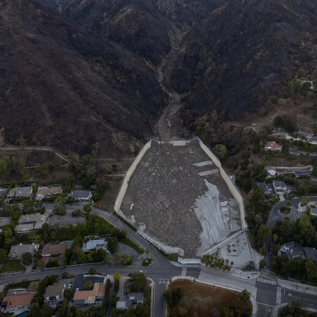
Debris Basins & Flood Control
How full is each basin, and how many yards to get it back to empty?
Basins are inspected in spring and cleaned out by December, and after a fire one storm can fill them. We fly the basin and the channel above it, compare the surface with the as-built or last baseline, and report percent full and cubic yards to remove for each basin, so crews know where to send trucks first and can verify what came out.
For flood control districts, public works departments and foothill cities · California · Metro Atlanta · South Florida
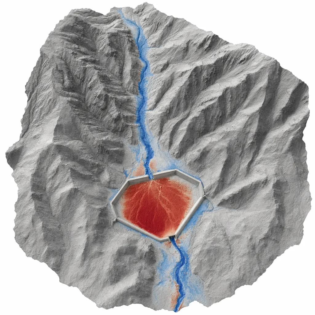
Illustrative sample
DEM of difference: sediment deposited in the basin since the baseline flight
Checkpoint report with every job
- Checkpoints
- 30
- RMSEz
- 3.4 cm
- Mean error
- +0.6 cm
Sample image and numbers are illustrative, not from a Twinn project.
Illustrative image
01Get a quote
Tell us the site and the deadline
Share the location, what you need to file and when it's due. We'll confirm the kit, the sign-off and the schedule.
02When you need it
What starts the job
- The first storms after a wildfire, when burned watersheds shed sediment
- Spring inspections and the push to finish cleanout by December
- Cleanout planning and verifying excavated volumes
- Emergency declarations and post-storm damage documentation
03What you get
Deliverables
- Per-basin fill percentage and volume tables
- DEM of difference against the baseline surface
- Classified point cloud and orthomosaic for each flight
- A short memo per storm, ready for the maintenance engineer
Already flying your own drone?
A camera drone shows how a basin looks. It can't see the ground under willows and brush, and it doesn't come with a checkpoint-verified volume. We re-fly the same path after a storm and report the change.
Already have a consultant?
We can work as a sub to your on-call engineer or surveyor, or directly on routine maintenance jobs.
04Before we fly
Sign-off, funding and equipment
Who signs it
Volumes used for engineering decisions are reviewed and signed by a licensed engineer or surveyor, yours or our partner's.
Funding rules
Routine district and city maintenance is usually local money. FEMA-funded post-fire work bars DJI aircraft, so we deploy US-made LiDAR or a compliant partner for it.
Drone compliance guide →Public sector work →Typical kit: Mapping-grade LiDAR on a DJI platform
DJI Matrice 350 or 400 RTK with Zenmuse L2, plus a GNSS base station. We source equipment per job, so the kit changes when your accuracy or contract calls for it.
Equipment guide →05Proof of accuracy
Sample checkpoint report
Every job ships with a report like this. We check the surface against independently surveyed points and report the error to ASPRS Positional Accuracy Standards, Edition 2 (2024). The numbers below are an illustrative sample for this kit, not a Twinn project.
Want the full deliverable? Get the debris basin status board sample.
Try it in 3D: debris basin storm tracker.
See how the data is collected: watch a 3D simulation of the survey flight.
- Accuracy class
- 5-cm vertical accuracy class
- Checkpoints (open ground)
- 30
- RMSEz, open ground
- 3.4 cm
- Mean error
- +0.6 cm
- Vegetated (VVA)
- 6.1 cm (20 checkpoints in brush)
| Point | Cover | Surveyed Z (m) | LiDAR Z (m) | ΔZ (cm) |
|---|---|---|---|---|
| CP-01 | Gravel road | 412.318 | 412.342 | +2.4 |
| CP-02 | Bare soil | 418.905 | 418.871 | -3.4 |
| CP-03 | Compacted fill | 431.227 | 431.259 | +3.2 |
| CP-04 | Bare soil | 426.540 | 426.517 | -2.3 |
| CP-05 | Asphalt | 409.112 | 409.148 | +3.6 |
| CP-06 | Gravel pad | 437.861 | 437.832 | -2.9 |
First 6 of 30 checkpoints shown. Illustrative sample.
06Where we work
California, Metro Atlanta and South Florida
California
Southern California runs hundreds of debris basins below burned watersheds. We focus on Los Angeles, Ventura, San Bernardino and Riverside counties.
Metro Atlanta
In Metro Atlanta the same method measures sediment in stormwater detention ponds and construction sediment basins.
South Florida
We serve Miami-Dade, Broward and Palm Beach counties. Florida public agencies may only use drones from approved manufacturers, so county and city work there gets an NDAA-compliant kit. Florida mapping deliverables are signed by a licensed Florida surveyor and mapper (PSM).
Background reading
Chen et al., Landslides (2026) ↗Caltech flew drone LiDAR over 14 Eaton Fire debris basins and reported 2-3 cm accuracy on bare ground. Independent research, not a Twinn project.
Tell us the site and the deadline.
Share the location, what you need to file and when it's due. We'll confirm the kit, the sign-off and the schedule.