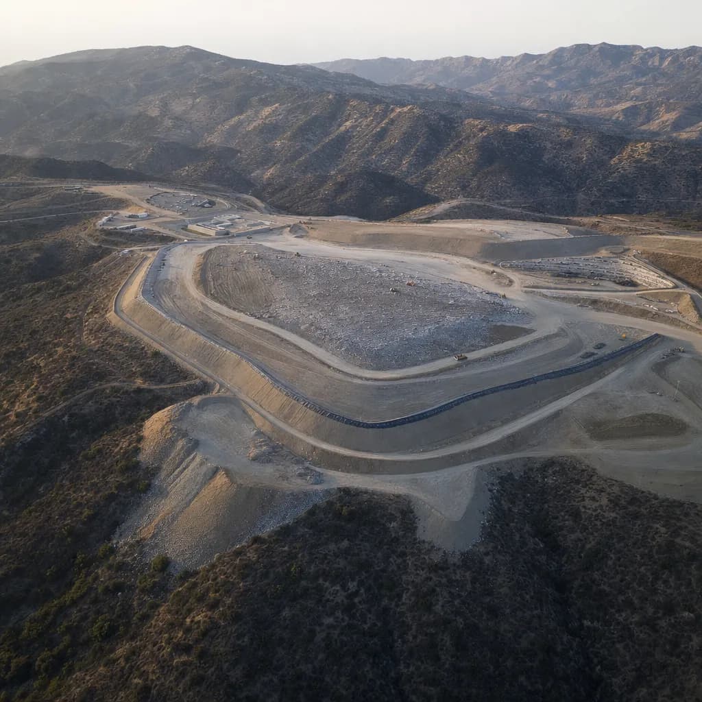
Landfills
How many years of airspace are left? Measured before the report is due.
Airspace is the product, and the permit fixes the date: a yearly topographic survey and a remaining-capacity number for the enforcement agency. We give your engineer airspace used, airspace left and years of life, checked against survey checkpoints, with an accuracy report and ready for a licensed surveyor's stamp. We pick the sensor for each site and your spec: drone photogrammetry on open fill, LiDAR where side slopes are vegetated, all modeled against the permitted final grade in time to file.
For landfill engineers, solid waste agencies and their engineering consultants · California · Metro Atlanta · South Florida
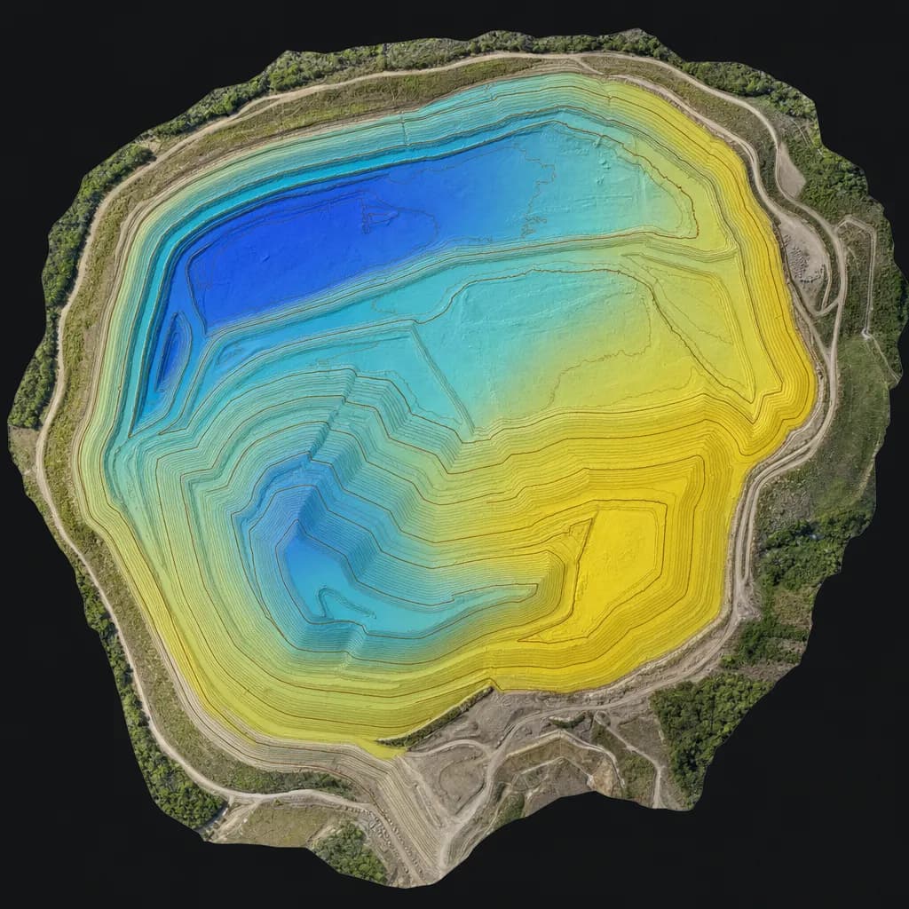
Illustrative sample
Fill surface with contours and remaining-airspace depth against design grade
Checkpoint report with every job
- Checkpoints
- 30
- RMSEz
- 3.4 cm
- Mean error
- +0.6 cm
Sample image and numbers are illustrative, not from a Twinn project.
Illustrative image
01Get a quote
Tell us the site and the deadline
Share the location, what you need to file and when it's due. We'll confirm the kit, the sign-off and the schedule.
02When you need it
What starts the job
- Permit-required annual topo and capacity report (several SoCal sites file in February)
- Fill-sequencing and grading plans for the next cell
- Settlement and cover-integrity maps for closed sites
- Fire or disaster debris using up airspace faster than planned
- An independent check of in-house drone or GPS numbers
03What you get
Deliverables
- Existing-ground surface and 1-ft contours (DWG, LandXML)
- Point cloud and orthomosaic from the sensor that fits the site (LAS/LAZ, GeoTIFF)
- Remaining airspace and fill volume tables against design grades
- Checkpoint accuracy report to the ASPRS 2024 standard
Already flying your own drone?
Keep it for progress photos and quick checks. Bring us in for the yearly capacity number: numbers checked against survey points, LiDAR ground where side slopes are brushy, a checkpoint accuracy statement your engineer can attach, and a licensed signature on the report.
Already have a consultant?
Most capacity reports come from an on-call engineering firm. We can fly and process for that firm, so the report keeps its author and its seal.
04Before we fly
Sign-off, funding and equipment
Who signs it
Capacity reports are signed by your licensed engineer or surveyor, with ground truthing on surveyed checkpoints. We work under their responsible charge, or bring a licensed partner when you need one. If your spec rules out a sensor, we fly the one it allows.
Funding rules
Landfill enterprise funds are local money, so DJI-based kits are usually allowed. We confirm against your contract before flying.
Drone compliance guide →Public sector work →Typical kit: Mapping-grade LiDAR on a DJI platform
DJI Matrice 350 or 400 RTK with Zenmuse L2, plus a GNSS base station. We source equipment per job, so the kit changes when your accuracy or contract calls for it.
Equipment guide →05Proof of accuracy
Sample checkpoint report
Every job ships with a report like this. We check the surface against independently surveyed points and report the error to ASPRS Positional Accuracy Standards, Edition 2 (2024). The numbers below are an illustrative sample for this kit, not a Twinn project.
Want the full deliverable? Get the annual landfill capacity report (draft) sample. Or try the landfill airspace and life tool.
Try it in 3D: landfill airspace and life.
See how the data is collected: watch a 3D simulation of the survey flight.
- Accuracy class
- 5-cm vertical accuracy class
- Checkpoints (open ground)
- 30
- RMSEz, open ground
- 3.4 cm
- Mean error
- +0.6 cm
- Vegetated (VVA)
- 6.1 cm (20 checkpoints in brush)
| Point | Cover | Surveyed Z (m) | LiDAR Z (m) | ΔZ (cm) |
|---|---|---|---|---|
| CP-01 | Gravel road | 412.318 | 412.342 | +2.4 |
| CP-02 | Bare soil | 418.905 | 418.871 | -3.4 |
| CP-03 | Compacted fill | 431.227 | 431.259 | +3.2 |
| CP-04 | Bare soil | 426.540 | 426.517 | -2.3 |
| CP-05 | Asphalt | 409.112 | 409.148 | +3.6 |
| CP-06 | Gravel pad | 437.861 | 437.832 | -2.9 |
First 6 of 30 checkpoints shown. Illustrative sample.
06Where we work
California, Metro Atlanta and South Florida
California
We plan December-January flights for operators in Los Angeles, Orange, Riverside, San Bernardino, San Diego and Ventura counties, ahead of February report deadlines.
Metro Atlanta
Georgia EPD-permitted municipal and private landfills face the same airspace questions. Georgia requires a licensed land surveyor to sign mapping deliverables, so Atlanta jobs run with a Georgia PLS.
South Florida
We serve Miami-Dade, Broward and Palm Beach counties. Florida public agencies may only use drones from approved manufacturers, so county and city work there gets an NDAA-compliant kit. Florida mapping deliverables are signed by a licensed Florida surveyor and mapper (PSM).
Background reading
CalRecycle permit conditions ↗An example SoCal permit that requires an annual topographic survey by a set date.
Tell us the site and the deadline.
Share the location, what you need to file and when it's due. We'll confirm the kit, the sign-off and the schedule.