Surveyors & Civil Engineers
LiDAR capture and processing for survey and civil firms.
We provide scoped aerial LiDAR, photography, video, or photogrammetry capture and processing for survey and civil firms. Your firm defines the project requirements and retains survey decisions and signoff under its responsible charge; we agree the files and handoff for each site.
For licensed land surveying firms and civil engineering primes · California · Metro Atlanta · South Florida
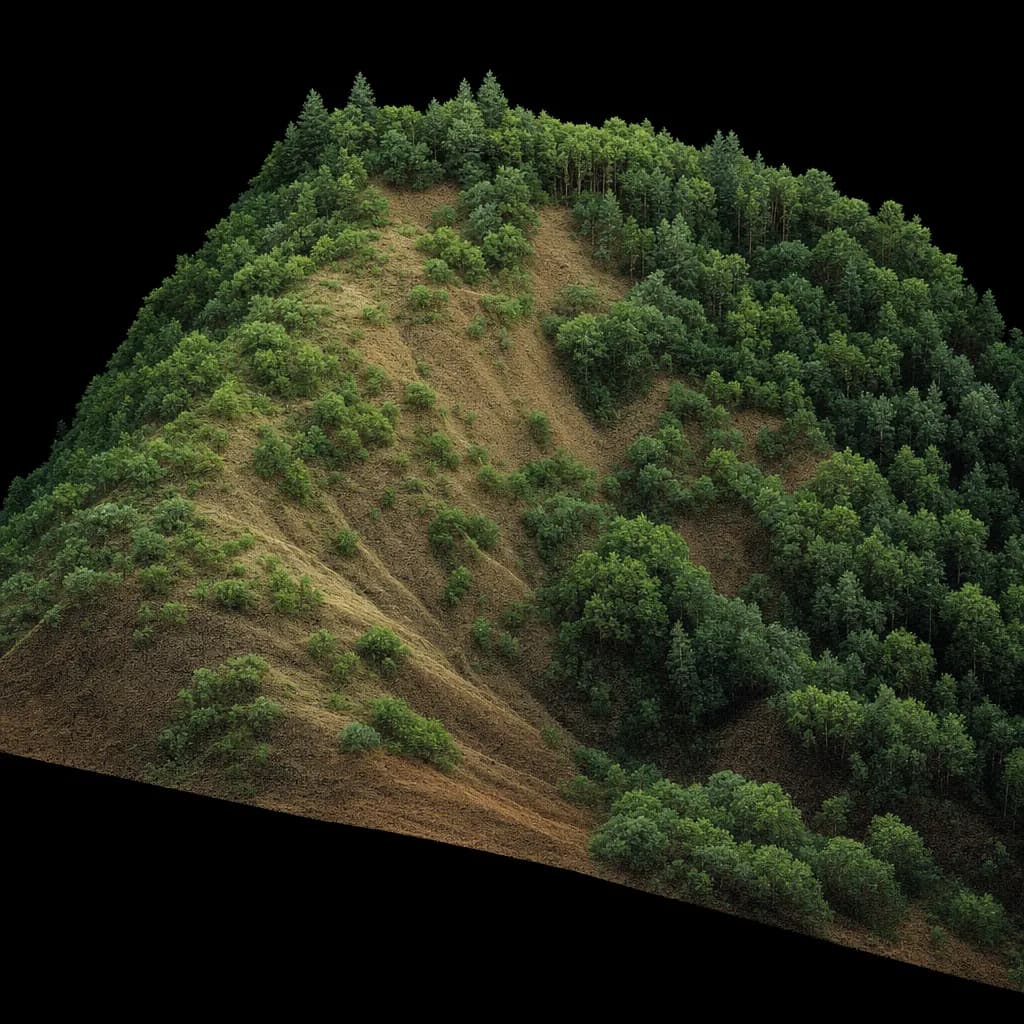
Illustrative sample
Colorized point cloud of a brushy slope; ground is classified out for your surface
Model QA workflow
- Review example file structure and selected format checks.
- Confirm project units, coordinate system, and layer conventions.
- Agree how your team will review the handoff.
Model package uses synthetic data. Civil 3D opening has not been tested; this is not field validation.
Illustrative image
01Get a quote
Share the site and handoff needs
Share the site, intended use, and file requirements. We can discuss capture and processing scope, handoff, and your firm’s review and signoff.
02When you need it
What starts the job
- Brushy, wooded or riparian sites where photogrammetry can't see the ground
- Additional capture or processing capacity when internal crews are committed
- A project scope calls for aerial data or terrain products
- Grading, drainage, or existing-conditions work with agreed file requirements
03What you get
Deliverables
- LAS/LAZ point cloud, classified if included in scope
- Terrain surface and contours in agreed formats, where included
- Orthomosaic or reference imagery, when included in scope
- Agreed coordinate system, units, and file handoff for your team to review
Already flying your own drone?
Your team may already fly a camera drone. We can add capture capacity and processing for project photos and video, photogrammetry, or LiDAR when the scope calls for it, including terrain work beneath vegetation. The approach is agreed with your team for each site and intended use.
Already have a consultant?
We support contracts you already hold with agreed drone capture and processing, including LiDAR, aerial photography and video, or photogrammetry. We work under your responsible charge, keep the client relationship with your firm, and leave scope and signoff with the licensee.
04Before we fly
Sign-off, funding and equipment
Who signs it
You stay the licensee in responsible charge and sign the deliverable. We never market our capture as a survey.
Funding rules
We match the kit to the job's funding: DJI for private and local work, US-made LiDAR when federal money or a state rule requires it.
Drone compliance guide →Public sector work →Typical kit: Survey-grade LiDAR
RIEGL-based or high-end US-made sensors such as GeoCue TrueView 660 or Phoenix RANGER. We source equipment per job, so the kit changes when your accuracy or contract calls for it.
Equipment guide →05Example deliverable
Model QA workflow
This example uses synthetic modeled data to show a file and QA handoff. Automated checks do not establish field accuracy, and opening the sample in Civil 3D has not been tested. Project QA and checkpoints are scoped with the responsible firm.
Want the full deliverable? Get the partner kit qa report sample.
Try it in 3D: 3d lidar measure and export.
See how the data is collected: watch a 3D simulation of the survey flight.
1 · Define
Confirm required formats, units, coordinate system, and layers with the firm.
2 · Check
Review selected file and schema properties in the modeled example.
3 · Handoff
Provide the agreed files for the responsible firm to review and use.
06Where we work
California, Metro Atlanta and South Florida
California
We discuss capture and processing support with firms across Southern California, with travel considered for Central Coast, Central Valley, and Northern California sites.
Metro Atlanta
For Metro Atlanta work, the project team should confirm applicable state requirements and arrange the required professional signoff.
South Florida
We serve Miami-Dade, Broward and Palm Beach counties. Florida public agencies may only use drones from approved manufacturers, so county and city work there gets an NDAA-compliant kit. Florida mapping deliverables are signed by a licensed Florida surveyor and mapper (PSM).
Background reading
California Board for Professional Engineers, Land Surveyors and Geologists, Bulletin 50 ↗The board's guidance that flying and capture are not regulated, but producing the map is.
Discuss a capture and processing scope.
Share the location, intended use, and handoff requirements for your team to review.