Already fly a Phantom? When DIY drone topo isn't enough
November 11, 2026
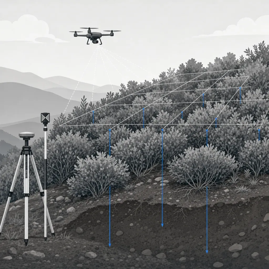
If you already fly a Phantom or a Mavic and process in Pix4D or DroneDeploy, you have done something right. You own a tool that answers real questions in an afternoon. This post is not an argument against it.
It is about the narrow set of jobs where the map becomes a number someone else relies on: a volume in a dispute, a contour set in a permit, a slope movement call. For those jobs, a camera drone has specific limits. Here they are, with the published numbers, and a checklist for deciding what to add.
The short version
- DIY photogrammetry is a good fit for progress photos, orthomosaics, reconnaissance and rough volumes on open ground.
- Vertical error depends heavily on ground control. Published tests range from about 1 cm with surveyed control to 23 cm and 2.2 m without it.
- A camera sees the top of the vegetation, not the soil under it. In one levee test, image-based terrain error grew from 14 cm to 36 cm as vegetation got taller.
- Topo for design or a permit needs a licensee in responsible charge. It should also have independent checkpoints and a stated datum. Georgia requires a PLS. California requires a PLS or a civil engineer authorized to practice land surveying.
- Commercial flying needs an FAA Part 107 remote pilot certificate.
What DIY does well
Plenty of geologists, biologists and public-works staff fly a basic Phantom. One geologist says: "we use a basic um phantom 4 dji it's um cost probably 1200 the the most expensive thing is is probably all the batteries because we have to fly so many missions" (James McNabb, geologist, 30:37). The same speaker says his crews have people on site survey ground control with RTK or PPK GPS, then use those points to georeference the point cloud (31:39). That is DIY done well, and it matters for what follows.
A restoration biologist on another panel calls their Phantom 4 Pro "a real Workhorse" after five years, and puts a Pix4D license at "maybe at least three thousand dollars a year" (panel, 27:33 and 28:10). Both prices are the speakers' own recollections.
DIY is usually enough when:
- You need dated progress photos and an orthomosaic for a file.
- You want a rough stockpile or cut-and-fill volume to compare month to month, and everyone accepts it is approximate.
- You are scouting: which parts of a site are worth a proper survey.
- The ground is open and bare, and the answer is not tied to a contract, a permit or a legal threshold.
If that is your use, keep flying. Nothing below changes it.
Limit 1: Control decides your vertical accuracy
A camera drone's onboard GNSS is not survey-grade. Photogrammetry software can fit a model to the images alone, but the model can bend, and the bend shows up mostly in elevation.
Three published tests show the size of the effect. Figure 1 puts them next to drone LiDAR.

Newcastle University, Phantom 4 Pro and Phantom 4 RTK. Peppa and colleagues flew a quarry and checked 19 independent points. With four GCPs, both aircraft reached about 29 mm vertical RMSE. When the team constrained the model with only the Phantom 4 RTK's camera positions and no GCPs, the vertical RMSE was 2.2 m and the horizontal 1.0 m. The authors describe a bowl-shaped distortion that four GCPs removed. They also describe the aircraft's camera positions as metre-level accuracy, as used in that run.
Wuhan University, Phantom 4 RTK with network RTK. Niu and colleagues flew at 35 m over a 180 m by 180 m square and checked 71 total-station points. With RTK and nadir images only, the vertical RMSE was 22.97 cm. Adding oblique images cut it to 5.58 cm. One GCP gave 3.08 cm, and four GCPs gave 1.15 cm. The authors conclude that some systematic vertical error may remain and that detailed topographic mapping may need GCPs.
Nevada DOT quarry, Phantom 4 Pro. A Pix4D case study flew 34 acres and surveyed 21 control points with a Trimble R10 RTK rover. Unused points served as checkpoints. Vertical RMSE was about 0.05 ft with 14 to 18 GCPs and about 0.1 ft with 4 to 10. With fewer than four, accuracy degraded, which the team attributed to the aircraft's onboard GPS not being very robust. This is a vendor blog post, not a peer-reviewed paper.
The pattern is consistent. The camera is capable. The georeferencing needs help. A handful of well-spread, surveyed GCPs closes most of the gap, and the geologist above already does it.
Limit 2: A camera cannot see the ground under vegetation
Photogrammetry matches features it can see. If leaves cover the soil, the model captures the leaves. Software can filter and interpolate, but it is interpolating from what it saw on top.
Salach and colleagues compared a UAV laser scanner and an image-based survey over levees in summer, using RTK-measured checks. Only the abstract was openly available for this review. In bare ground and low vegetation (0 to 20 cm), the terrain models were similar: 0.11 m for the laser and 0.14 m for images. Where vegetation was taller than 60 cm, the laser stayed at 0.11 m and the image-based model rose to 0.36 m. The authors report a loss of about 0.10 m of accuracy for every 20 cm of vegetation height in the photogrammetric data.

LiDAR is not magic either. It gets some returns through gaps in the canopy, and the filter must decide which returns are ground. Tamimi and Toth flew a Zenmuse L2 over a golf range in Michigan and checked it with a total station. RMSE was 7 cm on open road and 21 cm at forest checkpoints. DJI specifies the L2 system at 4 cm vertical and 5 cm horizontal at 150 m, under DJI's own lab test conditions, on a Matrice 350 RTK with RTK in FIX status.
So the honest comparison is this. On open ground, a well-controlled camera drone and LiDAR can be close. Under cover, only LiDAR has a chance to measure soil, and even then you should expect a larger error and test it. A later post in this series covers drone LiDAR accuracy under vegetation in more depth.
Limit 3: No independent checkpoints, no accuracy statement
Here is the quiet problem with most DIY maps. The software reports an error number, but that number is usually computed from the same control points that shaped the model. It tells you the model fits those points. It does not tell you how the surface behaves between them.
Pix4D's own case study makes the distinction. Control points are anchors the model is adjusted to. Check points are used only to compare the result with surveyed values. ASPRS Edition 2 says the same thing: checkpoints should be an independent set that was not used in processing or calibrating the product, and they should be of higher accuracy than the product.
How many? The standard asks for a minimum of 30 checkpoints for the results to be reported as meeting its requirements. Georgia's rule sets a floor that scales with size for UAS elevation data. Figure 3 compares them.

Two details from Georgia's Rule 180-7-.04 are useful even if you are not in Georgia. Positional checks "should include a reasonable portion in areas with ground cover and within the interior of the project," not only easy, visible spots. And the surveyor must report the result of the checks, listed individually or as an average.
A practical example. For a 20-acre site in Georgia, the rule's floor is 8 positional checks. ASPRS asks for 30. A surveyor may choose to run more than the floor. This is a reasonable thing to ask before you quote.
ASPRS also treats vegetated ground separately. It reports vegetated vertical accuracy as found, without a pass or fail threshold, so a good open-ground number says little about what is under the brush.
Limit 4: Datum and geoid errors hide in plain sight
A drone's GNSS reports heights above an ellipsoid. A topo, a floodplain map or a pad elevation uses a vertical datum, which in the U.S. today is usually NAVD 88. Turning one into the other needs a geoid model, and a mismatch or a missed step can shift every elevation by the same amount. The map still looks perfect.
NOAA's National Geodetic Survey says NAVD 88 is biased by about half a meter and tilted about 1 meter coast to coast relative to the best global geoid models. It says modernizing the reference system will change existing latitude, longitude, ellipsoid heights and orthometric heights by as much as four meters. Check which datum and epoch your client, agency or surveyor expects before you deliver.
Georgia's rule makes this explicit. Any elevation product must state the vertical datum and how it was verified on the site, name the contour interval or vertical precision, and show at least three fixed positions for future work. That is a good template for any deliverable, licensed or not.
Limit 5: Some deliverables need a licensed stamp
Flying and capturing are one thing. Delivering contours, a DTM or a stated accuracy is another.
California. The Board for Professional Engineers, Land Surveyors, and Geologists said in Bulletin 50 that flight planning, piloting and obtaining the photography are not regulated by the Professional Land Surveyors' Act. But when an operator creates a topographical survey and gives it to a private client or public agency, the operator "must be authorized by law to perform land surveying." B&P 8726 includes determining the contour of the earth's surface by photogrammetry, creating electronic data in that work, and rendering a statement about the accuracy of maps or measured survey data. The work needs a PLS or a civil engineer legally authorized to practice land surveying. Under B&P 8731, that means a civil engineer licensed before January 1, 1982; later civil engineers need a land surveyor license. A later post in this series covers who can sign a drone topo in both states.
Georgia. Rule 180-7-.04 says that producing contour maps and elevation data to typical survey precision, "and the advertising thereof, is considered to be the practice of Land Surveying." It applies to data from "unmanned aerial systems (UAS)." That means a Georgia PLS.
This does not stop you from flying your own site for your own use. It does mean that a DIY topo handed to a city, a design team or a permit reviewer needs a licensee who has seen the raw data, the control and the checkpoint results. This is general information, not legal advice. Call the board when a case is unclear.
Limit 6: Commercial flying has FAA rules
If you fly for work or business, the FAA says you can do so under Part 107 with a drone under 55 pounds. To fly under Part 107, you need a Remote Pilot Certificate. That means passing the initial aeronautical knowledge exam and completing online recurrent training every 24 calendar months.
The basics in 14 CFR 107.51 include a 400 ft altitude ceiling above ground level, with a structure exception, a 100 mph groundspeed limit, and at least 3 statute miles of flight visibility. Visual line of sight (107.31) and operating over people are separate rules, and some operations need a waiver or an airspace authorization.
If the work uses federal money, also check the current covered-entity status of your aircraft manufacturer on SAM.gov and with the funding agency before you fly. This post does not make that determination.
A decision checklist
Use this before you decide how to capture.
1. DIY is fine when
- The output is photos, an orthomosaic or an internal rough volume.
- The ground is open and bare.
- Nobody will rely on it for design, a permit, a payment or a legal threshold.
- You are comfortable saying "approximate" in writing.
2. Add ground control and checkpoints when
- You need elevations or volumes that someone will check or dispute.
- Your aircraft has no RTK or PPK, or you have not tested it on your site.
- The site is large, steep or has a lot of relief.
- You can place and survey at least a few well-spread GCPs, plus a separate set of independent checkpoints. Use more checkpoints when the result will be reported. ASPRS asks for 30.
- You can state the datum and epoch, and how it was tied to the site.
3. Bring in LiDAR and a licensee when
- Brush, grass taller than about 60 cm (from the one levee test above), or trees cover the ground you need.
- The deliverable is topo, contours, a DTM or a stated accuracy for design or a permit.
- A regulator or agency expects a stamp (a PLS in Georgia, a PLS or an authorized civil engineer in California).
- You need a defensible change measurement, like slope movement, where the error must be small next to the signal.
- A deadline or a storm means you cannot spend a week on control and processing.
The thresholds in item 3 are a judgment, not a published rule. The 60 cm figure is the class break in one study.
Where Twinn fits
Twinn is a capture and processing service. It rents the right equipment for each job and is not tied to one aircraft or sensor. A DJI Zenmuse L2 is one example of a LiDAR sensor, not a promise. Flights are planned with software agents under human supervision, and a human FAA Part 107 remote pilot in command flies them. Operations are insured for $2 million.
Twinn captures and processes. A licensed partner, or your own licensee, sets the spec, places control and checkpoints, and stamps the result. Raw data, trajectory, processing logs and a checkpoint report in the ASPRS Edition 2 format go to the person who signs.
Keep your Phantom for progress shots. A service is for what it cannot do: ground under vegetation, an accuracy statement checked against survey checkpoints, and a re-flight after a storm.
Next step
Take your last DIY map and pull any 10 to 30 points you surveyed independently of the model. Compute the vertical RMSE yourself and sort it by cover class: open, grass, brush. If the open-ground number is fine and the brush number is not, you have your answer. If you want a capture and processing partner that works under a licensee's responsible charge, see the surveyors and engineers page.