Metro Atlanta's Granite Quarries: Permits, Production and the Year-End Pile Count
November 16, 2026
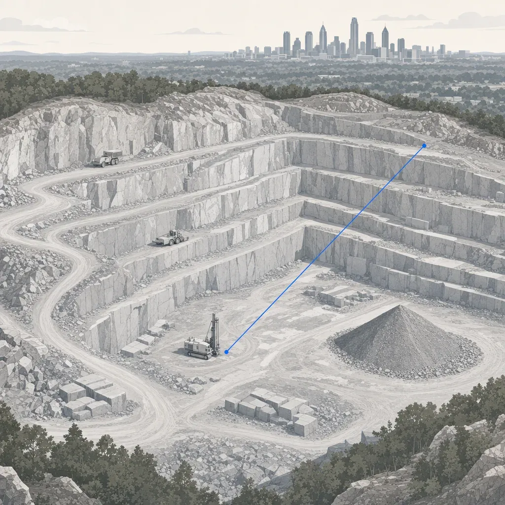
Georgia produced 67.3 million metric tons of crushed stone in 2023, and EPD lists 19 granite permits inside the 11-county Atlanta region. Every permitted site answers to a mining plan and a yearly report that asks for acreage as of December 31.
This post looks at the public record: where the permitted granite sites are, how much stone Georgia moves, and what the state asks of a permittee. Then it turns to the practical question for a plant manager or controller in December. How do you get a defensible pile count and a disturbed-acre number from the same flight? Every figure below was built from public files, and the post marks every number that is calculated here rather than quoted.
Where the granite permits are
Georgia EPD publishes a list of permitted surface mines, revised April 2026. The file has 769 permits, each with a latitude, longitude and permitted acreage. Granite is listed as the mineral type on 77 of them.
The Atlanta Regional Commission names 11 counties: Cherokee, Clayton, Cobb, DeKalb, Douglas, Fayette, Forsyth, Fulton, Gwinnett, Henry and Rockdale. Filtering the EPD file to those counties gives 19 granite permits covering 9,454 permitted acres. That is about a quarter of the state's granite permits.

| County | Granite permits | Permitted acres |
|---|---|---|
| DeKalb | 4 | 2,539 |
| Gwinnett | 2 | 1,344 |
| Forsyth | 2 | 1,033 |
| Fayette | 2 | 899 |
| Cherokee | 2 | 848 |
| Douglas | 2 | 739 |
| Henry | 1 | 728 |
| Clayton | 2 | 706 |
| Cobb | 1 | 330 |
| Fulton | 1 | 288 |
| Rockdale | 0 | 0 |
Table 1. Tally of the EPD file, April 2026 revision, calculated here. Permit counts depend on how EPD labels the mineral type.
Three readings of this table matter for a survey scope.
- DeKalb carries the Lithonia cluster. Four permits sit within roughly seven miles of each other, going by the listed coordinates, and the largest is 1,236 permitted acres.
- A permit is not a pit. Permitted acreage is the land the operator may disturb. The disturbed footprint is smaller and changes every year.
- The list is incomplete for your purposes. It shows granite only where EPD recorded granite. A site mined for "stone" or "aggregate" under another label may not appear in this filter.
How much stone Georgia moves
The USGS Minerals Yearbook reports crushed stone by state. Georgia's 2023 number is 67,300 thousand metric tons worth $1.67 billion, or $24.76 per metric ton. In the same table, Georgia ranks sixth among states and holds about 4.3 percent of the US total of 1,550,000 thousand metric tons. The rank and share are calculated here from the table. The table also counts 97 active operations and 76 active quarries in Georgia for 2023.

Output rose from 53.2 million metric tons in 2017 to 67.3 million in 2023, about 26 percent, calculated here. Unit value rose faster, from $15.55 to $24.76 per metric ton. Two cautions on reading the chart:
- USGS revises prior years. The 2018 figure is 53,400 thousand tons in the 2018 edition and 53,300 in the 2019 edition. The chart uses the latest edition retrieved for each year.
- "Sold or used" is shipments, not the pile in the yard. It tells you the scale of the business, not what any one quarry holds on December 31.
Georgia's aggregate association says the demand side looks steady. In a recent workshop interview, its executive director said state budget dollars for transportation, used by GDOT along with federal dollars, mean "a constant pipeline of projects that are coming into the state."
What EPD asks of a permittee
The Georgia Surface Mining Act of 1968 is the authority, and Rule 391-3-3-.01 says the rules are adopted under it. Four parts of the rules touch survey data.
- Permit and plan. Rule 391-3-3-.02 requires a permit before mining, and the permit is conditioned on compliance with the approved Mining Land Use Plan. A permitted operator that mines land outside its permit risks suspension or revocation of its permits.
- The plan's contents. Rule 391-3-3-.05 lists affected acreage, a schedule of mining advancement, highwall reduction, grading and sloping, and erosion control. Changes to the plan must be approved as an amendment first.
- Bonding. Rule 391-3-3-.03 says bond requirements "will be fixed in an amount of not less than $1,000 nor more than $2,500 per acre or fraction thereof of the area affected land." An operator may ask the Director in writing for an exemption.
- Maps. Rule 391-3-3-.07 allows an aerial photograph in lieu of a map if the operator has plotted the land use data on it, within stated scale limits of 330 to 660 feet per inch.
One more fact belongs here. The same rule 391-3-3-.02 says dimension stone quarries are exempt by law. This post is about crushed-stone granite, not dimension stone.
The annual report asks for two acreage numbers
EPD's Surface Mining Permit Annual Report form (the copy opened for this post is marked Rev. 12/19) has a short acreage section. It asks for the number of permitted acres as of December 31, and the number of permitted acres disturbed as of December 31. It also asks whether all mining was on permitted acreage and whether best management practices for erosion and sediment were maintained.
That is why December 31 matters in Georgia. The disturbed-acre number is a measurement, and you can put a polygon behind it.
A worked example shows why the number carries money. Suppose a permit covers 400 acres and 250 are disturbed. At the rule's range of $1,000 to $2,500 per acre or fraction thereof, a bond on 250 affected acres would fall between $250,000 and $625,000. These are illustrative numbers, not any real site, and EPD sets the bond case by case. The point is that a few acres of difference moves the figure by thousands of dollars.
The year-end pile count
Acreage is half of a December flight. The other half is inventory.
John Scepaniak, a North Dakota aggregate contractor on the Dirt Talk podcast, explained why his company bought a drone. It had a job where it surveyed a 300,000 ton stockpile, and the scale tonnage and the customer's loadout disagreed enough to matter. On converting tons to yards, he is blunt: it "depends what you're making how much air is in the pile how much did it rain yeah that gets real messy."
He also describes the timing problem. He flies a site when a plant moves. Then it is December 16th, he is quoting work, and the question is how much rock is left in the pit. A dated surface answers that without a site visit.
What a pile count measures
A survey gives you volume. Tons come from a factor you control.
- Capture the pile surface and the ground it sits on. A base surface from a flight before the pile was built is best. Otherwise the surveyor interpolates a base from the pile's edge, which adds an assumption.
- Compute the volume between the two surfaces, pile by pile, using polygons you approve.
- Convert to tons with your own factor. That factor comes from your scale records and your product, not from the survey. Check whether your records use short tons or metric tons, because the USGS tables above use metric.
- Reconcile with the books: opening inventory plus production minus sales should land near the measured closing count. A gap is a finding, not necessarily an error.
How much does survey error matter on a pile?
Volume error from a vertical bias is footprint area times the bias. It does not depend on how tall the pile is. Take a 1.5 acre pile footprint, about 6,070 square meters. A 5 cm bias moves the volume by about 304 cubic meters, or about 397 cubic yards. A 7 cm bias moves it by about 425 cubic meters, or 556 cubic yards. The same biases over a 40 acre quarry floor compared year over year give about 10,600 and 14,800 cubic yards. Those are calculations with illustrative areas, and they describe a systematic bias. Random noise partly averages out over many cells.
Two lessons follow. Big flat areas cost more cubic yards per centimeter than small tall piles. And a closing count only compares fairly with last year's if both surveys used the same datum and the same method.
What free public elevation data can and cannot do
You can see a lot before you hire anyone. The USGS 3D Elevation Program publishes 1 m bare-earth models for the Atlanta area. Figure 3 is the 3DEP tile covering one granite permit on the EPD list, number 083-17 in Kennesaw, Cobb County. It shows a hillshade and contours computed from the model. The site was picked only because it is in the public record. Twinn has no relationship with its operator.

The model shows benches, haul roads and the pit rim clearly. It cannot give you this year's pile count, because the data is a snapshot from the project's collection year and a working quarry changes every week. A bare-earth model also cannot see below a water surface, so a flooded floor needs another method.
Georgia's rule for surveyed elevation data adds a further limit. Rule 180-7-.04 requires a surveyor's drawing that shows uncertified data, including data from a public agency, to carry the statement that it "was obtained from (state source) and is not certified as correct by this surveyor," and that users "do so at their own risk." Public data is for planning. Treat it that way.
Accuracy: what to ask for
DJI specifies the Zenmuse L2 system at 4 cm vertical and 5 cm horizontal at 150 m, measured in a DJI laboratory environment. An independent test by Tamimi and Toth reported 0.07 m RMSE on an open road and 0.21 m under dense canopy with an L2. Treat the lab figure as a best case and the field figure as the planning number.
Bare gravel piles are probably close to the open-road case. The quarry rim, the berms and the tree line around the permit boundary are closer to the canopy case. Both statements are inference, not test results. The canopy case matters more for the disturbed-acre polygon than for the pile volume.
The ASPRS Positional Accuracy Standards, Edition 2 express vertical accuracy as RMSE and require at least 30 checkpoints to test elevation data. It also says vegetated vertical accuracy should be evaluated and reported, not used as a pass or fail test. So ask for three things in writing:
- RMSEv from independent checkpoints, with the count and where they were.
- Checkpoints on hard, bare surfaces, plus a separate figure for vegetated areas.
- The horizontal and vertical datum, and how it was tied to a monument.
Who signs in Georgia
In Georgia, producing contour maps and elevation data "to typical survey precision or for use in applications typical for surveying works" is the practice of land surveying, and it must be done by licensed individuals and authorized firms. The rule names LiDAR and unmanned aircraft explicitly. It requires positional checks, direct supervisory control when production staff are not employees of the responsible surveyor, and a stated vertical datum. In Georgia that means a Professional Land Surveyor.
Twinn captures and processes the data and does not stamp. If a deliverable goes to EPD, a county or a design team, a Georgia PLS needs to be in responsible charge. Whether an internal inventory count for your own books falls under the rule is a question for your PLS, not for a blog post. The compliance page explains how Twinn splits the work.
A short list to settle before a December flight
- Base surface. Do you have last year's closing surface, or a pre-pile ground survey? If not, say how the base will be built.
- Polygons. Agree the pile boundaries and the disturbed-area boundary before the flight, not after.
- Factors. Know your tons-per-cubic-yard factor by product and whether it is moisture-adjusted.
- Checkpoints. Plan at least 30 on hard surfaces if the data will be used for anything formal, and report RMSEv.
- Wet pits. Flag standing water now. It changes the method.
- Federal money. If federal funds touch the work, check SAM.gov for the maker of the aircraft and sensor before you book anything.
- Signer. Name the Georgia PLS and what they will sign.
If you run a granite or aggregate site in Metro Atlanta and want a year-end count with a documented method, Twinn can scope it. Twinn rents equipment per job and is equipment-agnostic. Flights are planned with software agents and flown by a human FAA Part 107 pilot, and Twinn carries $2 million in insurance. See the mines and aggregates page to start a conversation.